


Returning home is the most difficult part of long-distance hiking; You have grown outside the puzzle and your piece no longer fits.
- Cindy Ross
Taking the 512 bus from Liseberg station directly to the start/end of the trail, this is a good 10km hike through forests which won’t stress too many hikers out.
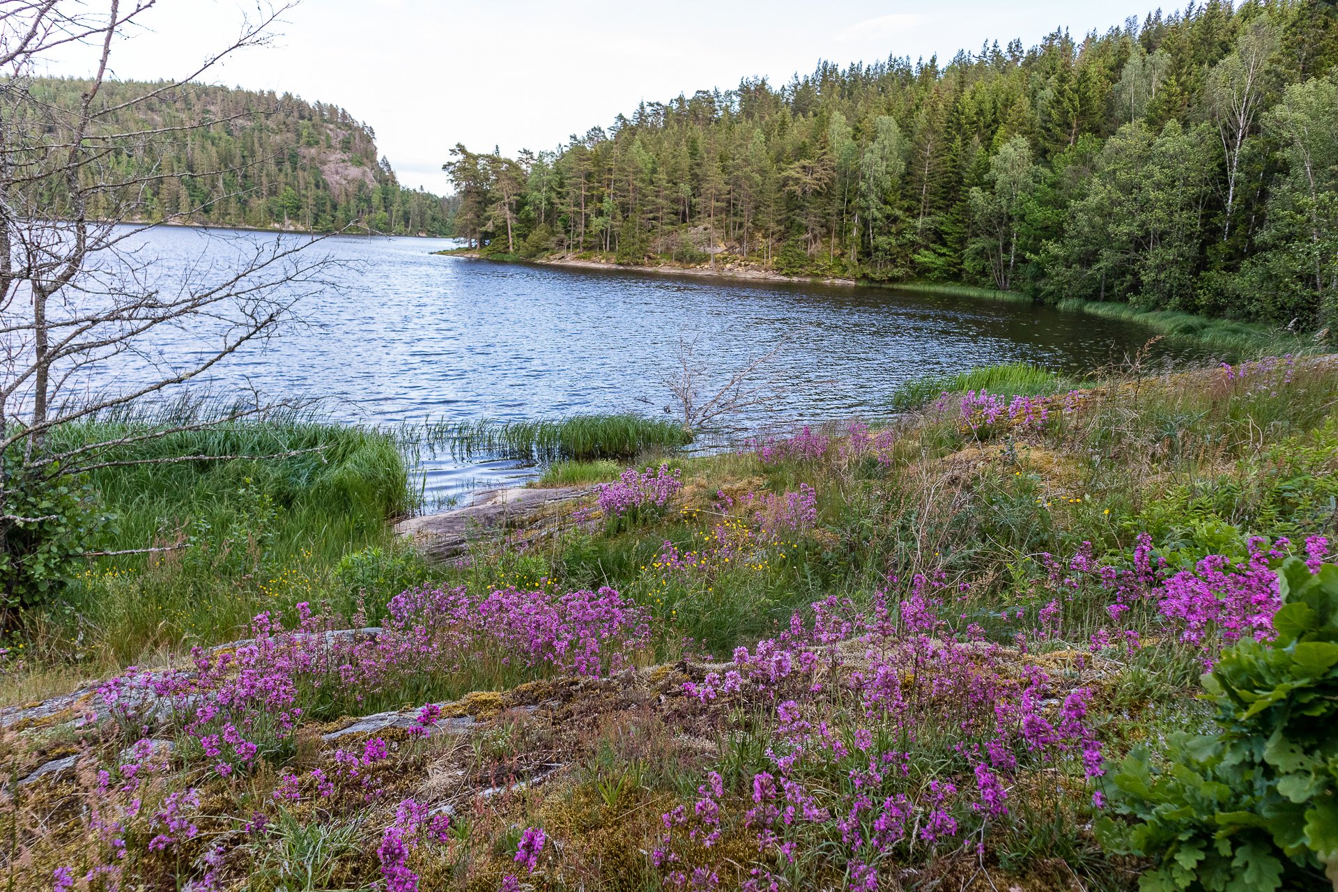
Smooth gravel roads and a well-organized trail, a large urban nature reserve and Gothenburg's most central recreation area welcome the hiker on the second section of the Bohusleden trail.
Other than a short rocky section similar to the final stretch to Mweke Camp, the trail is in good condition, but almost everything was aching for the final descent.
You' start the hike at the edge of the Alpine Desert, after about an hour of climbing in the dark you enter the Arctic Zone, but it is incredibly hard to know when you’ve actually reached this point as you are hiking in darkness and seeing very little but the ground under your feet.
Imposing, and surrounding Barranco camp on three sides, the climb up is challenging, but rated as a ‘scramble’ so you don’t need to be an expert. A lot of sites call it the ‘Death Wall’ and throw around terrifying descriptions of how you have to hug the wall to avoid plummeting to your death.
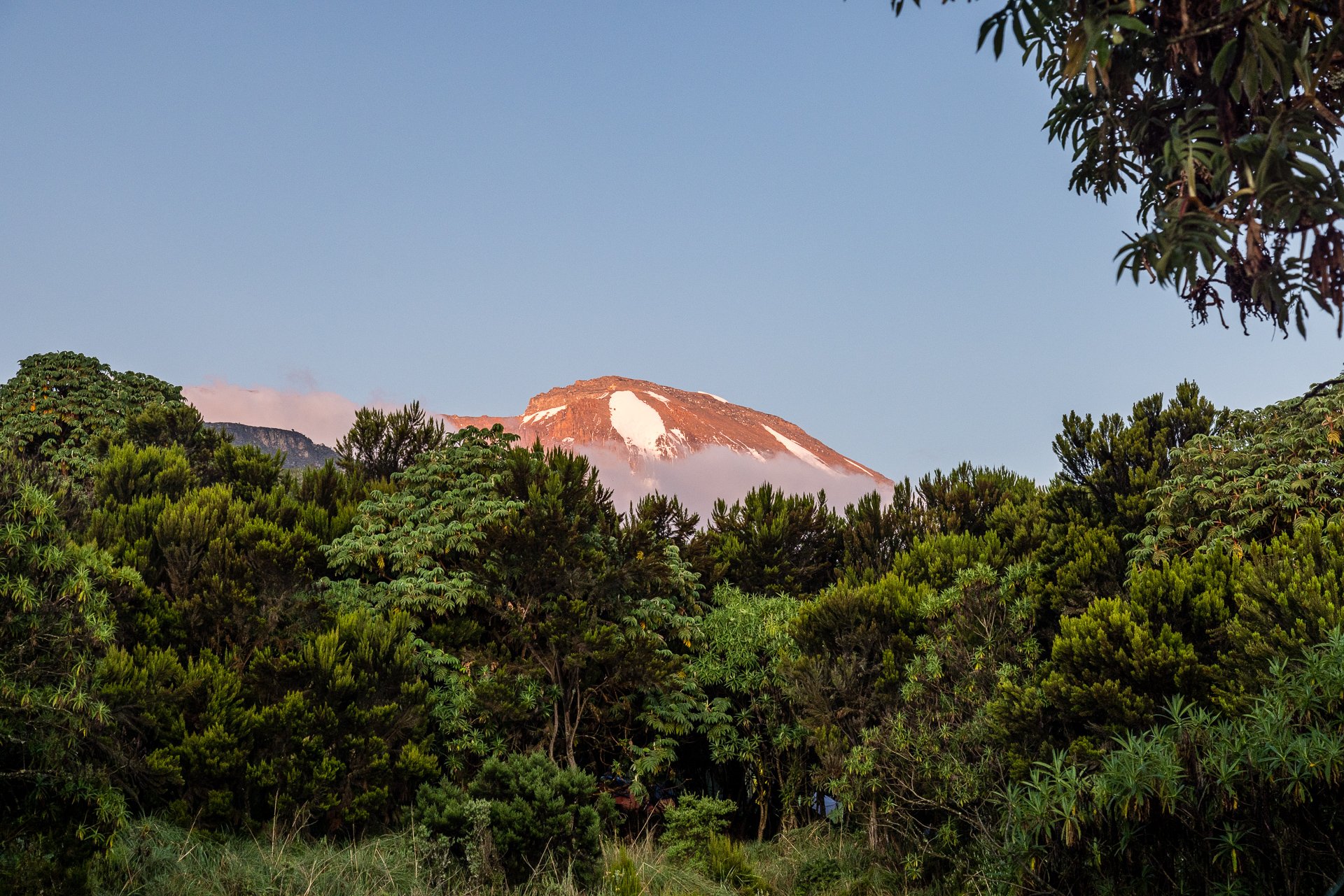
The Lava Tower is impressive, rising up in front of the campsite, dark stone causing a shadow over the tents. Its easily visble from some distance due to the flat plain around it.
Machame is nestled in the forest, and so is quite free from wind. It also is layed out in clearings and so each group has some small level of privacy from each other.
The Gate is one of a handful of entrances to Kilimanjaro and the start of the Machame Route. Many tours will prepare a lunch or breakfast for hikers on their trips, served in covered terraces with seating and long tables.
A much easier trail than the previous two sections with limited changes in altitude and good pathways. The trail opens out into more settled areas, going through fields, and along a few roads. Past Diseröd a chance to climb a small mountain can be taken.
Moving from Etap 09's wilderness to a much more rural space, you'll frequently see evidence of the long history of people living and working on the land. Three wind shelters can be found on this trail, Vindskydd Tvängen, Vindskydd Holmevatten and the one we stayed at detailed below.
Running through Svartedalen, the Black Valley, this is a challenging section of the hike, with a lot of climbing and descending. There are plenty of lakes, but few moving rivers, so be aware of water needs. There are several good huts on the trail, as well as a lot of places to stop and camp.
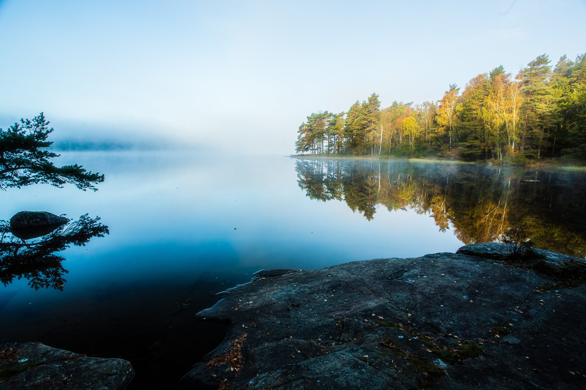
One of the amazing things about living in Gothenburg is the closeness to nature. A few of us left from work on a Friday and took the train up to Surtesjön, a lake north of Gothenburg. A quick hike from the station and we found a spot for camping, cooking and swimming by the edge of the lake.
Reached easily from Central Gothenburg via Angered Centrum, Vättlefjälls Naturreservat is one of the largest nature reserves in the area and a lovely place to spend a weekend camping and hiking.
Not really a town so much as a shopping mall with a collection of accommodation and ski options, Hemavan sits on Bluvågen and acts as either the start or end of the trail.
The final stage on the King's Trail, the trail has many signs of civilization as this section is also heavily used in winter for skiing. There is a reasonably steep uphill section before you head downhill into Hemavan. The final kilometre or so into Hemavan is on real roads when you reach the Naturum and the archway signalling Kungsleden's end.
Starting at the King's Trail's oldest cabin, the section between Syter and Viterskalet offers one of the best views of the trail, the entrance to the final valley with Norra Sytertoppen on one side. (The hike up to Norra Sytertoppen is a wonderful side trail and worth the climb) Once you enter the valley, the trail is easy and even, and the scenery remains spectacular.
Perhaps a unique section of the trail, you walk along the water’s edge for much of the 14 kilometres between Tärnasjö and Syter, passing several bathing spots and sand beaches before hiking over a series of bridges connect many islands. The final uphill section to Syter is quite tough after an otherwise easy stroll.
The trail between these two cabins is fairly up and down but not very steep, and so its more a hill walk than a climb. The scenery is beautiful through this reasonably short section of the trail.
Lush grassland gives way to rocks and pools as you climb ever higher on the trail from Aigert to Serve. This section has the highest point and the steepest ongoing climb of the Southern part of the King's Trail (Tjäkta being the highest overall). After reaching the emergency cabin at Juovvatjåhkka, you have a fast climb down before a shorter hump and an eight-kilometre gentle descent to reach Serve.
A short trail and starting from the town of Ammarnäs, it quickly moves into beach forests with some spectacular waterfalls to cross on bridges. Following breaching the treeline, you have a short walk, with great views back over Ammarnäs and the delta before reaching Aigert and its two small lakes.
At 21 kilometres, this section is about average but starts, after crossing the river at Rävfallet, with a steep uphill climb to reach the plateau, which takes up most of your hike. The downhill at the end gets very steep into Ammarnäs as you're crossing a ski slope. The final section from the bottom of the trail into the centre of Ammarnäs is on tarmac roads.
Starting with a hike or optional boat ride along the lake, the trail from Adolfstrom to Rävfallet is one of the longest sections. It starts with forest hiking before moving up to above the treeline and hiking along plains and rocks. A reasonable section of the trail, with Sjnulttjie as an option, if the weather turns bad, Be aware, a few kilometres around Sjnulttjie, you pass through a bird sanctuary with restrictions on where you can camp. Much of the rest of the trail to Rävfallet is in the shadow of the nearby hills and on good trails, with the final section in a deep forest before you come to find the cabin at Rävfallet.
A fairly short stretch that starts with a lot of climbing through Beach forests. Plenty of water is available as you hike along, and the final stretch is a reasonable downhill through good trails to reach Adolfstrom.
A challenging uphill hike from Vuonatjviken South to the tree-line turns into a simple hike across the plateaus, ending with a long forest hike into Jakkvikk, with a short stretch on a resupply road. A few kilometres outside of Jakkvikk, you'll be rowing a boat 300m, which may be challenging if it is your first attempt.
One of the longest stretches between accommodation, this wilder section of the King's Trail offers diverse terrain but some stunning views. As it is much wilder and on the edge of the Arctic Circle, you'll encounter a lot more variety of flora and fauna, but this is also where you really start to get the mosquito swarms.
Silver ore was discovered close to what is now Kvikkjokk in the 1650s, and shortly after, in 1661, a Luleå silver plant with a smelter was constructed. Almost 400 years later, 18 permanent residents, as well as a larger number of vacationers, make their home here. Perhaps the fulcrum point on the King's Trail sat between the well-serviced north route to Abisko and the wilder section to Ammarnas. Also, from Kvikkjokk, easy transport options exist into Jokkmokk and various other hiking opportunities in the area.
Walking along lake edges for much of this section, Pårtestugan to Kvikkjokk is a fairly easy hike through forests, and there is even Dáhtá beach to relax on if you choose to. It is mostly through humid forests with some really nice bridges over the numerous waterways, its an easy trail into Kvikkjokk.
The boat is a short walk from Aktse, so make sure you leave time to reach it before the departure time. The trip is a short hop over Lájtávrre and then a hike through forest and marshland before you climb the edge of a hill.
Starting with a nice boat ride across Sitojaure, the hike following landing is a stretch through the forest as you climb higher and higher and break the tree-line before a short plateau walk and then a steep climb down, which becomes very steep approaching Aktse.
Almost immediately into a heavy green forest, there is a short but steep climb upwards before plateauing and having a consistent hike along the grasslands. The final stretch into Sito is a reasonably gentle downhill walk. As an easy hike, you can make perfect time between these two points, but given the fixed boat schedule from Sito, this may leave you cooling your heels in the STF station.
The first half of this trail is uphill and can be quite strenuous. The summer hiking trail, once you reach the top, takes you on a detour from the winter to find the bridge over the river. Despite being high, the terrain is marshy after the river and for much of the summer will likely be a muddy slog, continuing gently uphill.
Crossing through Sjaunja, Sweden's second-largest nature reserve and part of Laponia's World Heritage site, the section of trail is short, though with a reasonably steep uphill section about halfway through. Once at the summit, the walk is flat, but it can be challenging to find the trail as much of the terrain in the last few kilometres is large rocks. Keep a close eye on the markings and don't be fooled by the winter trail markers.
This section runs alongside the sizable Tjäktjajäkka river and has several places where you likely need to remove your shoes to wade across the stone beds of smaller feeder streams. Deep enough that its unwise to cross just trusting to your boots waterproofing the water is bitingly cold on your feet and it is very much worth bringing some boat shoes with a grip, just for these crossings.
Much of Kungsleden follows North to South canyons, but this section gives you the chance to look into those valleys crossing West to East as well. If the weather is clear, you can see Sweden's highest mountain, Kebnekaise in the distance and many follow the side trail from STF Singi.
Through this section of the trail, you pass the highest point of Kungsleden. Despite this, it is not the most challenging climb of the route. Even during the summer months, there will be blankets of snow to cross. Keep a careful watch on the ground and probe ahead with a hiking pole or stick. There can be a sudden drop of as much of a foot where stones below the snow have shifted.
This section of the trail is mostly through a wide valley with spectacular mountains all around. It's a reasonably gentle hike, with some areas over wood planks. (Be cautious here if the weather is wet as it is easy to slip on the untreated wood). The second half of this section is quite rocky, and as you reach the STF cabin, you come close to a narrow but impressive river carved from the rock.
Initially continuing through the birch forest, the trail then opens out after you leave the nature reserve. Just after the toilet and campsite, you cross a wide river by bridge and begin the first of many climbs on Kungsleden.
Much of this section of Kungsleden runs through Birch forest, alongside the rapid river Abiskojåkka, often as a low canyon with some impressive rapids.
A shorter stage of only 13km is marked as a difficult trail and has some areas with ropes to assist climbing; it also has some steep slopes to hike. The final third of the trail, as you reach stage 13, is comfortable
The route goes through the varied and sometimes dramatic countryside through dense spruce woodland, steep cliff-edges, past lakes, and an old rural landscape.
Approximately 110 kilometres around, the Utvandraleden, or Emigrants Trail is a picturesque hike giving you a chance to see some of the sights of Vilhelm Moberg’s quadrilogy of tales abut the Swedish farmers and labourers who headed out to the United States in search of a better life.
This section of Bohusleden is only 8 kilometres long and is of moderate difficultly. Lots of dirt trails and gravel tracks make the eight kilometres fly by. Several lovely lakes dot the hike's distance.
At the end of the season, a friend and I headed out to the forests east of Gothenburg for a short weekend hike. It was the first evening that the temperature dipped to -4 degrees and so we had a very cold evening.
Perhaps the most challenging trail in the forest for its size, you will be climbing two challenging hills just under five kilometres long. Stora and Lila Trollkyrka. The trail shares a long section with trail 5 (Blue) and gives you the chance to see the two famous hills and a few other sights.
The longest single trail in the park, the purple Trehörningsrundan, circumnavigates the lake. Entering from Vitsands it would be easy to assume it is an easy and often walkwayed hike, but it is actually one of the most challenging to complete.
One of the longer trails in the park is winds between rift valleys and faults formed a thousand million years ago. Much of the hike is through mossy wet spruce forests, but at one point, you reach Tjádersogen.
Connecting to both the purple (4) and white trails (7), Sigmansrundan is a medium length trail through primary undergrowth and old-growth forest. It is fairly easy, and you can move quickly through it. There is a mix of lichen and dry areas along with fairly humid forests. We found a likely looking large rock, climbed up and had lunch there, watching people walk past us.
Squire Hunter’s trail is fairly short, twice the length of Tärnekullerundan, and does not have the same variety of terrain to make it as interesting, but it does have two particular things to make it worth while. Firstly it is a good bridge onto trail 9, rather than using the purple trail, and secondly, there is the famous Boulder.
Tärnekullerundan was perhaps the best trail in the park that we hiked despite being 1.3 kilometres long.
After leaving Skoved, you are heading back into the forest, but on regular roadways rather than trails. You also pass a tiny homestead or hamlet with a couple of houses and the 64km sign, marking the midway point of the High Coast trail. There is no other sign of reaching the middle.
This trail, though listed as intermediate flew by, taking you through grasslands and forests, its pretty and quaint, but before you know it you’ve reached Skoved and are on the final section to Ullånger.
The south entrance is much like the north, with toilets, and sheltered seatings with a fire-pit and various rubbish bins. There is a view point back over the forest (or forward across what you will see if you are hiking north to south.
About one kilometre past the North Entrance is one of the few locations you are able to camp in the National Park. The right of roaming does not apply here. There was, but all accounts, a nicer place to camp another four kilometres further on, but by this point I’d been walking about 14 hours and was exhausted.
I missed this entire section, as my friend gave me a lift by boat to Köpmanholmen and then by car to Entré Nord. However, whilst there is some nice scenery at the tail end of route 11 that I missed, all of Route 10 is walking along the main roads through Köpmanholmen. One day I will come back and do the whole of the Höga Kusten trail, but when time is a premium, I advise you to skip it if you can.
Just past the connection of Route 12 and 11, my Turkish friend stopped at a campsite for some food and a break. Like me he had been walking since 5:30 am, but unlike me, he had taken the High Coast trail the whole way and so had had a tall hill to climb, that I’d missed by going along the coast through Paddal.
From here, I was back on the main trail and had made a friend—a Turkish video game developer who lived in Stockholm who was also walking the High Coast Trail. We ended up walking together for about two hours, it was a nice break from the silence, but I think we were both glad to go our separate ways eventually.
I missed a great deal of this trail due to the diversion and then following the main road along to Svedjeholmen, however, the path itself at this point is not a great deal different to the walking I ended up doing.
Some friends and I went hiking in Bottenstugan i Svartedalen, an area of natural beauty north of Gothenburg. The trails connect to Bohusleden, meaning you can trek back the 50 or so kilometers to Gothenburg, something a few of us plan to do.
The trail is marked as difficult and goes through some heavily wooded areas with some steep climbs. In total, it is 12 kilometres.
I once again got up at 5:30 to try and capture the sunrise. The air was brisk and the sky still dark as I sought out options for my shooting location.
This was the final full day of the trekking and it was tough. I made a huge mistake in packing by putting all my spare lenses in the porter’s bag
I dragged myself out of bed at about 5:30 in order to take photographs of the sunrise. It was ok, but not stunning, more because of the clouds than anything else, but it led to a nice open image of the mountain.
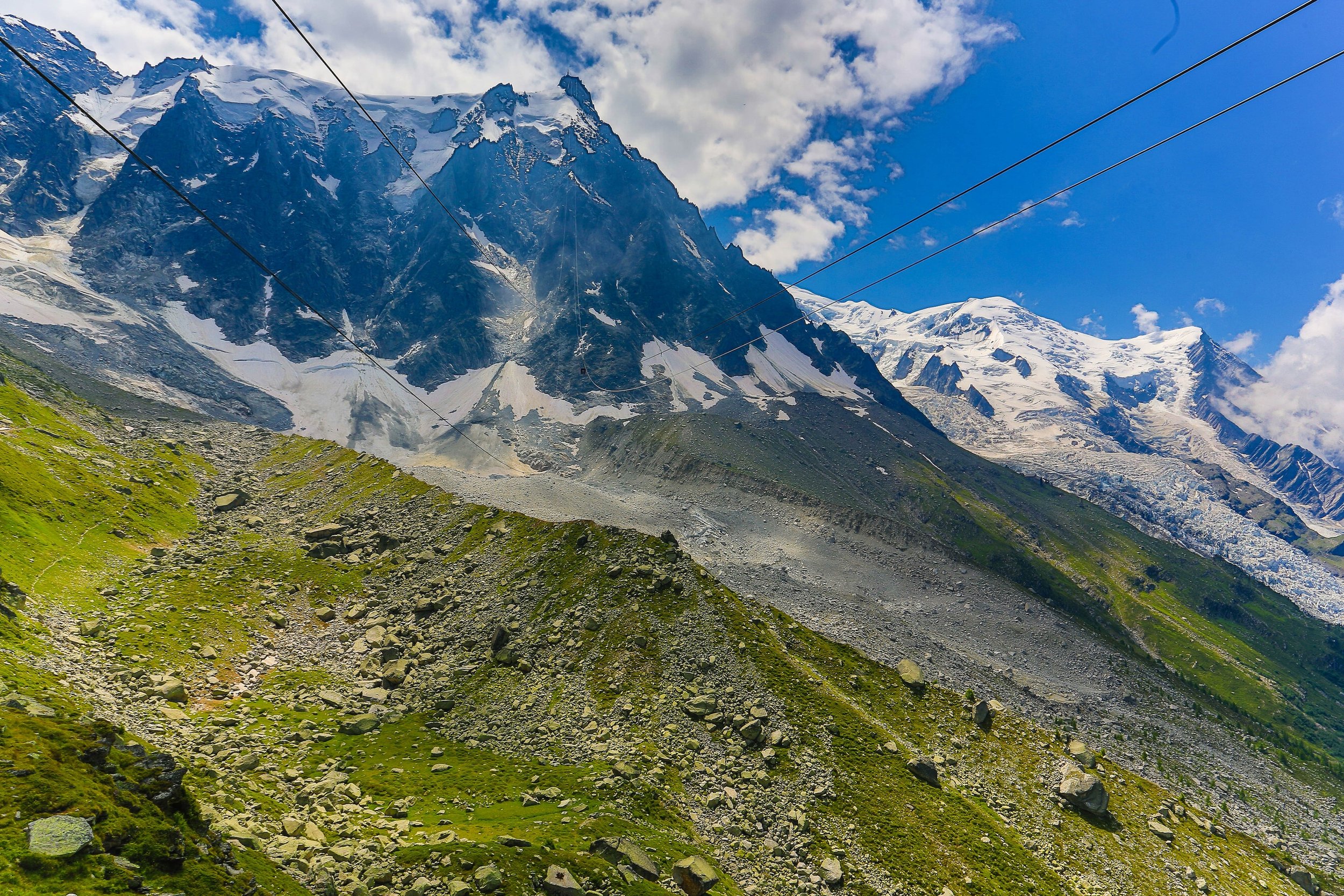
After about an hour of bouncing along the roads, once we’d managed to make it out of Kathmandu, we got our first proper glance at the Himalayas. They are, in a word, breathtaking.
Hikes
-

Annapurna, Nepal
After about an hour of bouncing along the roads, once we’d managed to make it out of Kathmandu, we got our first proper glance at the Himalayas.
-

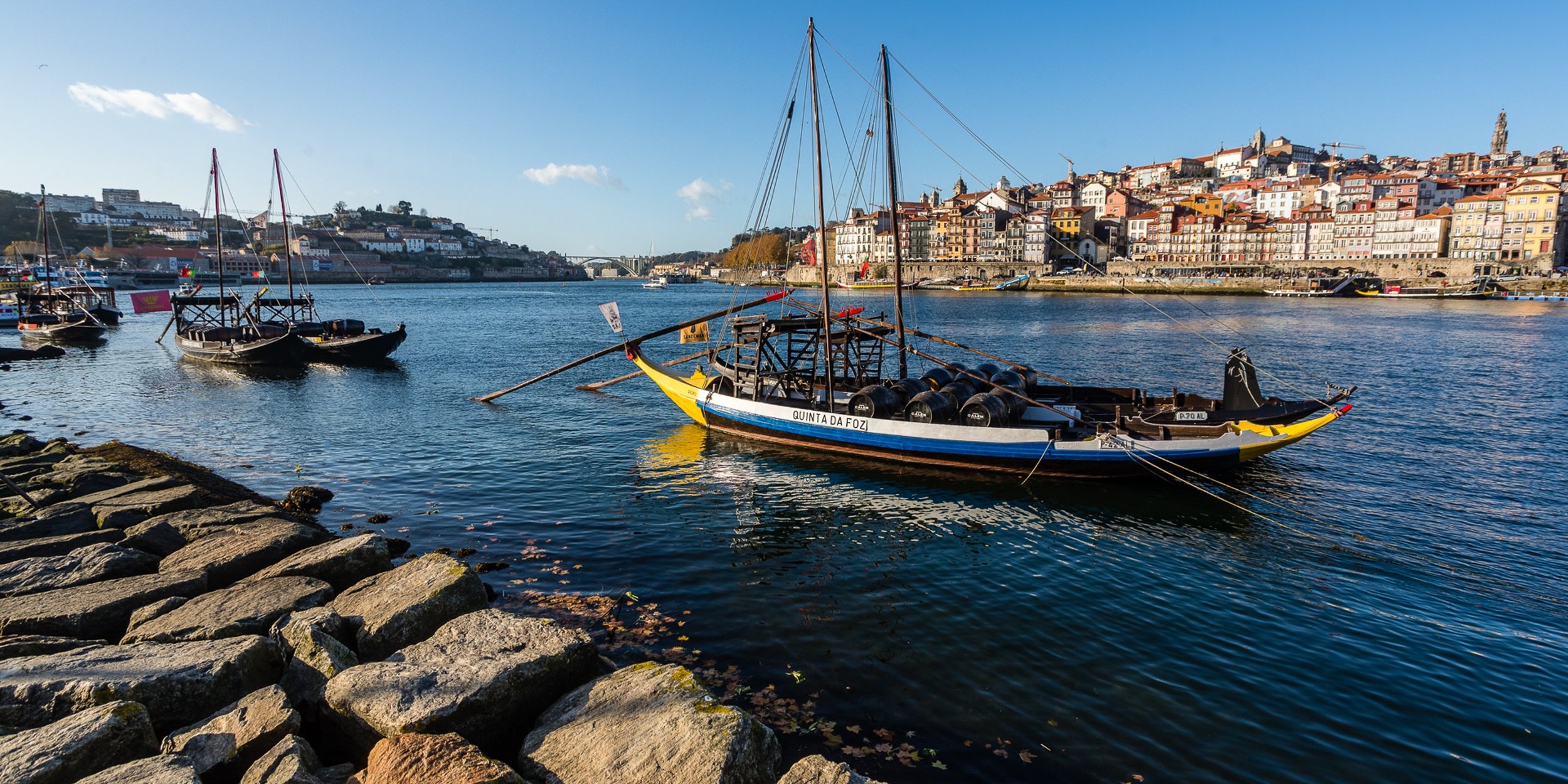
Bohusleden, Sweden
Bohusleden is a trail that stretches over 370 kilometres through the heart of Sweden's stunning landscapes. This trail is a journey through dense forests, over tranquil lakes, and across rugged cliffs, offering a chance to experience the untouched beauty of Sweden.
-
Gotaleden, Sweden
A 71 kilometer trail from Gothenburg to Alingsås.
-

Höga Kusten, Sweden
Höga Kusten, or the High Coast, is a hiker's paradise nestled in the heart of Sweden. This trail is a celebration of nature's grandeur, offering a unique blend of towering cliffs, verdant forests, and the serene Baltic Sea. As you traverse the trail, you'll be treated to breathtaking views that are a testament to the power and beauty of natural forces.
-
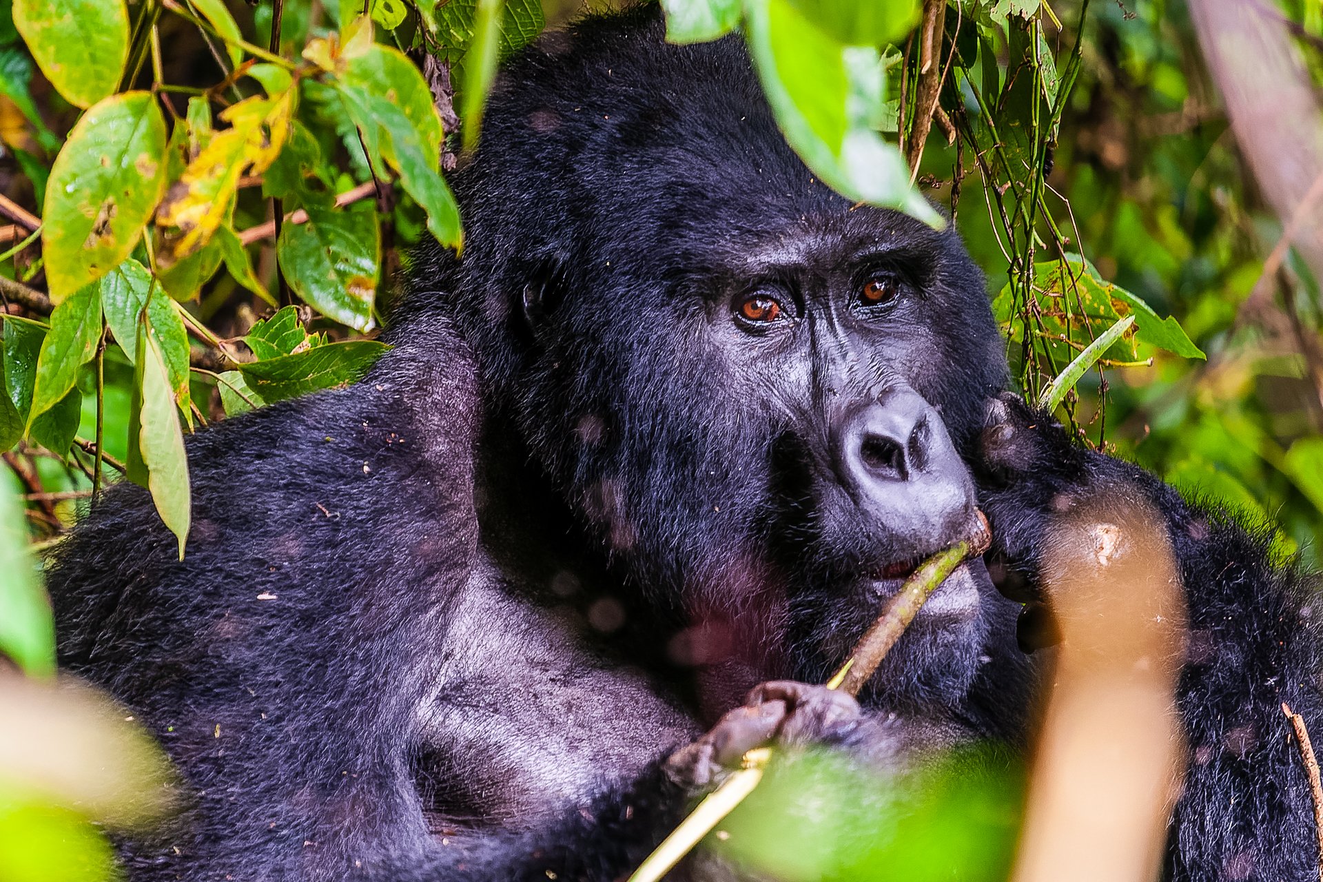
Kilimanjaro, Tanzania
Turning 42 on the slopes of Kilimanjaro, I hiked the Machame route from Machame Gate to Uhuru Peak, and down to Mweke Gate.
-

Kungsleden, Sweden
It all begins with an idea. Maybe you want to launch a business. Maybe you want to turn a hobby into something more. Or maybe you have a creative project to share with the world. Whatever it is, the way you tell your story online can make all the difference.
-

Tiveden, Sweden
Once a refuge for outlaws during the Middle Ages, Tiveden National Park is now a sanctuary for nature lovers. Whether you're drawn to the towering 15-metre boulder known as the Junker Jägare's stone or the serene forest trails, Tiveden offers a unique blend of history and natural beauty.
-

Utvandrarleden, Sweden
Approximately 110 kilometres around, the Utvandraleden, or Emigrants Trail is a picturesque hike giving you a chance to see some of the sights of Vilhelm Moberg’s quadrilogy of tales.

Route 10 - Köpmanholmen to Entré Nord
I missed this entire section, as my friend gave me a lift by boat to Köpmanholmen and then by car to Entré Nord. However, whilst there is some nice scenery at the tail end of route 11 that I missed, all of Route 10 is walking along the main roads through Köpmanholmen. One day I will come back and do the whole of the Höga Kusten trail, but when time is a premium, I advise you to skip it if you can.