Öland
Öland has been inhabited since 8,000 BCE by Palaeolithic hunter-gatherers, who crossed the ice that sometimes forms on the Kalmar Straight. As a result, it feels old but tamed in a way much of Sweden does not. Its smaller landmass and heavily farmed spaces make it feel a little like the English countryside. Still, then occasionally you travel past standing stones in a farmers field, giving you a brief glimpse into its uniquely Scandinavian history.
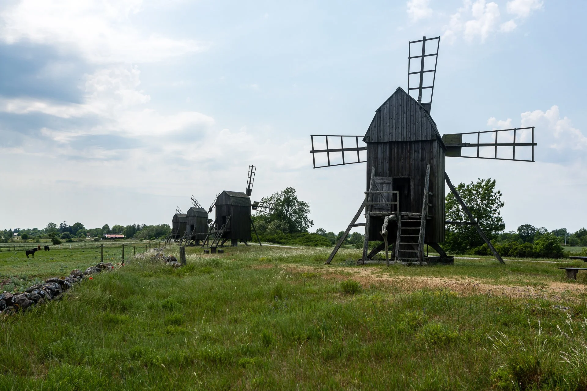
There is a preponderance of old windmills, once as many as two thousand, only 350 remain on the island but driving around, you'd be surprised it is so few.
At its broadest, Öland is only 16 kilometres, though it is 137 kilometres long. Two main roads run up the coasts, merging into a single route for the final spire of northern land.
During my visit it was Midsommar, and men and women were out in force collecting wildflowers during the morning before driving around the islands on tractors with their family laying out on a trailer behind them. From time to time, I'd pass a family picnicking on the grass with one girl wearing the flower crown.
Sights & Culture
Villages
Borg
Borg is a tiny village or hamlet but home to Saint Knute's Chapel and Gråborg, one of the largest strongholds in the Nordics. First written about in 1371, the hamlet is more a working farmstead, a strange mixture of old and new with ancient stones, warped boards and more modern materials blended. Even after all this time, they form a traditional Öland row village, cattle-sheds along the main village road. Since 1810, when the farmland was divided between two farmers, it has taken on its current appearance.
Since 1945, the village of Borg has been owned by The Royal Swedish Academy of Letters, History and Antiquities. The local farmer-supervisor farms the area.
A series of hikes can be taken from a short kilometre or two to see Gråborg and St. Knutes Chapel out to 25-kilometre walks around the local spots like Noah's Ark.
A small shop and cafe are right by the car park offering handicrafts, and guest toilets are on the border of the car park.
Stora Rörs
A small harbour on the west coast of Öland with an excellent bakery and cafe called Mormor's as well as a small shop offering local produce. Lovely views over the water and a small sandy beach. Many more modest and less showy boats are moored here.
Borgholm
Despite its tiny population of just over three thousand residents, Borgholm is still considered a city due to its historical importance to Sweden, which would typically require a minimum of 10,000 to be a city.
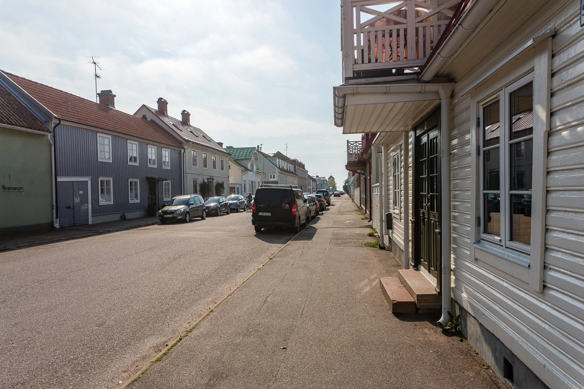
The city is one of the most popular summer vacation spots, and the harbour is filled with incredible yachts. Restaurants are scattered through the city, and in the main square, a helpful map highlights which restaurants are open all year round and which are only open for the summer season.
On Sweden's Riviera, the yuppie-styled wealthy Swedes are in abundance, but so are obvious holidaymakers in Hawaiian shirts and some locals in more simple attire. It's a blending of wealth, wishfulness and work that is perhaps uniquely Swedish.
A strange mix of cars passes through Borgholm, with the occasional Lamborghini following a beat-up, rusty clunker.
The church is a colourful central building and easy to navigate by.
Chapels & Churches
Sankt Knuts Chapel
Construction of Saint Knutes chapel begun in the late 12th century and it saw a few hundred years of service before being abandoned in 1527 with the Swedish Reformation. It was named for one of the two Danish Saint's named Canute.
During the chapels operation, Gråborg was likely used as a trading station, explaining it's higher than the usual number of gates.
The Chapel is relatively small, but the ruins remain in good condition, with a substantial archway and a single tall wall.
Sankta Britas Kapell
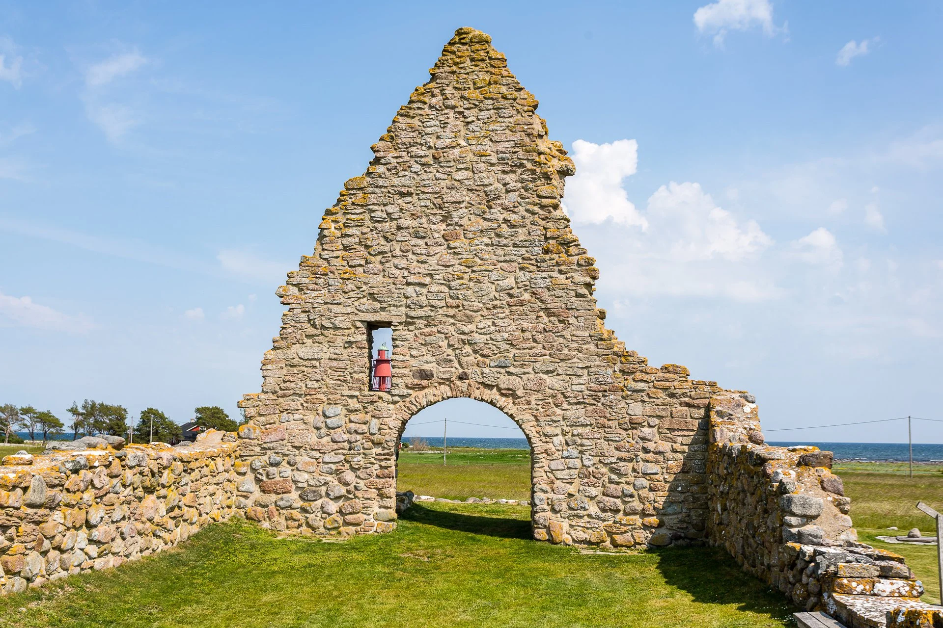
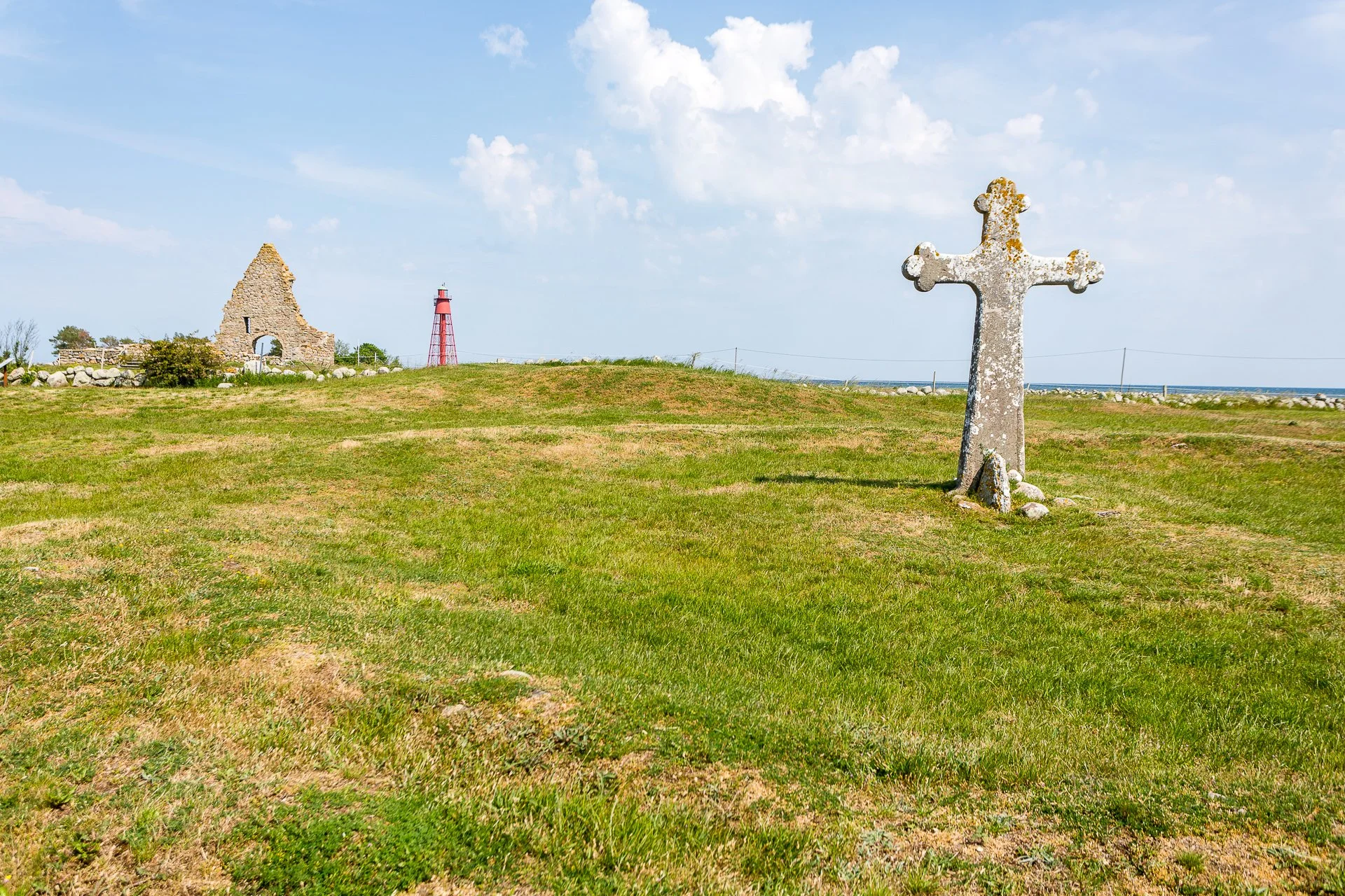
All that remains of the Chapel is the foundations and the eastern gable. The western gable collapsed during a storm in 1914. It was first mentioned in 1515, though its construction style can be dated to the 13th century.
It is one of the larger medieval churches in Öland and was likely named for the Irish Saint Brigida. The Chapel had a high roof covered by monk and nun tile, a rather unusual detail for the time because of its costliness.
Through its remaining window, you can see the nearby Kapelluddens Fyr or Kapelluddens Lighthouse. Its location on the sheltered coast has lead to many visitors seeing it and spending time on the beach.
Sankt Johannes Kapell
Easily accessed by a lay-by on the road to Lange Jan, the Chapel was built by merchants in the 13th century, and only traces remain, though a small model of the building can be seen.
Connected initially to Kyrkhamn, the merchants who constructed the Chapel brought their own priest, and the building was both Chapel and closely guarded warehouse.
In the 1780s, what stones remained of the Chapel were used in the construction of the Långe Jan lighthouse.
Forts & Castles
Gråborg
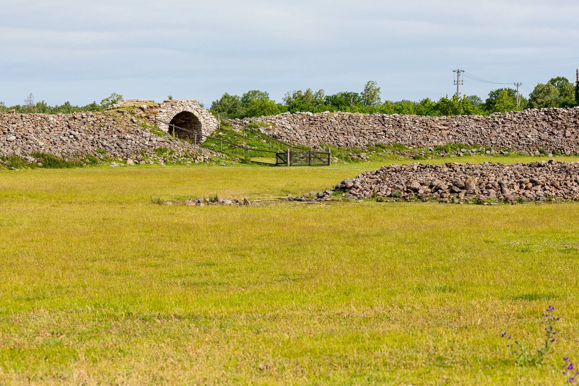
Gråborg is the largest of the 15 strongholds on Öland and one of the largest Nordic regions. It was in use since 300 AD, and its location in the centre of the island is a prosperous area lead it its prominence as a trading point. The locals were experts in cattle rearing and leatherworking, with their goods being exported to the roman empire for their soldiers.
The stronghold was restored towards the end of the 12th century, and effort was made to reinforce the wall. It is speculated Gråborg was a fortified trading site, essential to Denmark, Sweden and Slavik nations. However, relatively few military finds from this period indicate it had a peaceful rather than wartime presence.
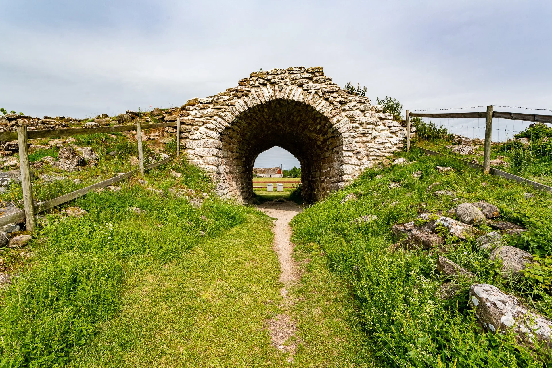
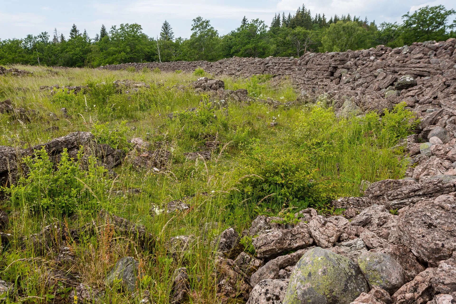
The northwest archway gate from the 13th century is the only gate remaining, with other entrances being just gaps in the walls. The walls were up to ten meters high, though they currently are only 4-7 meters tall. They are made of stacked flat stones rather than rock or brick.
The tumbles or rocks and high grasses and flowers in the protected interior have proved to be a boon for birds, with songbirds filling the interior, flying and singing as you explore.
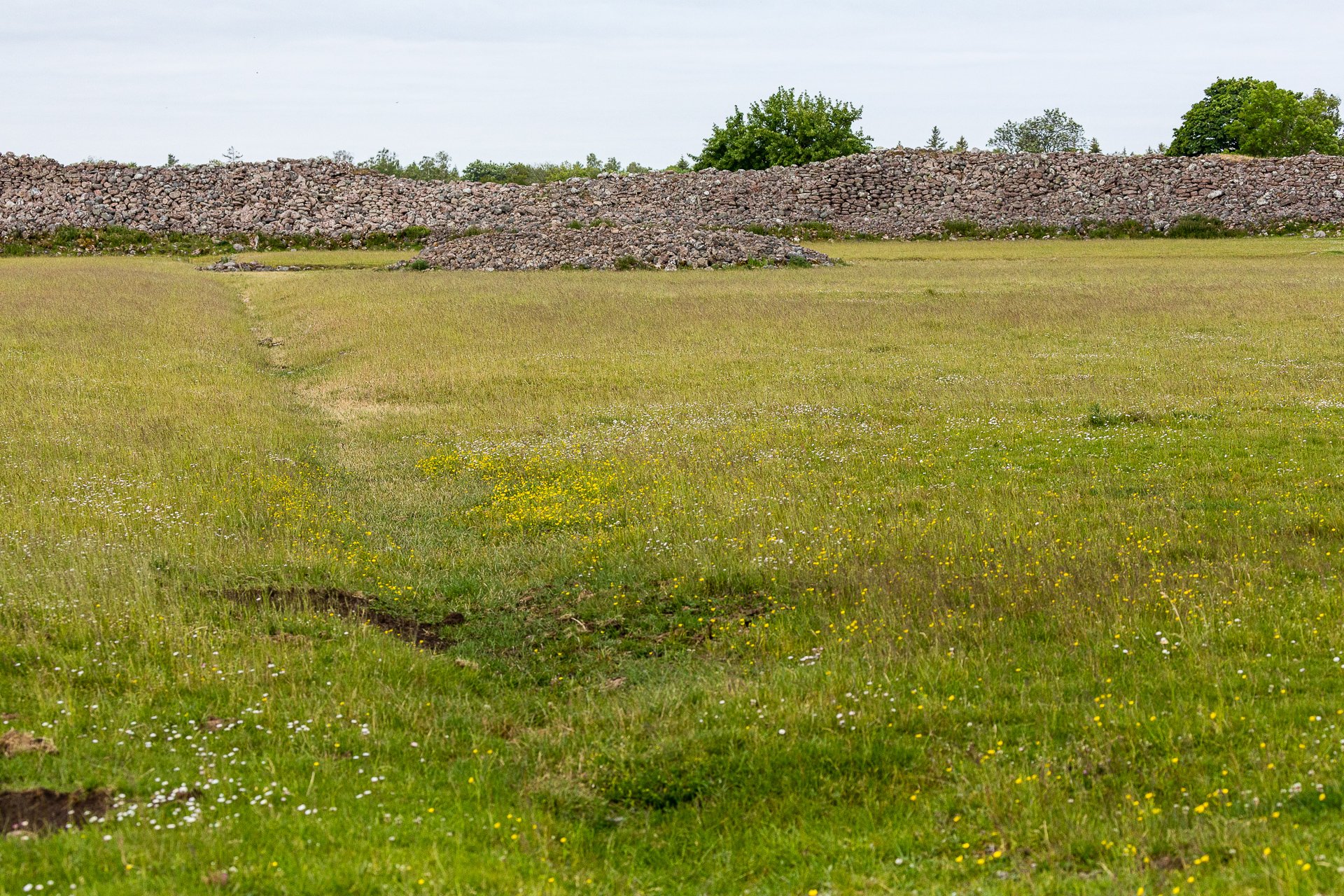
On the ground, there are a few channels, which may have been water or, more likely, pathways. Very little to indicate the streets and buildings remain in Gråborg.
Ismantorps Fornborg
Built sometime in 2-300 CE and used until 600 CE, the nine entrances cause historians to think it was designed according to the nine worlds of Nordic myth. Moreover, its setup shows the evident Roman influence on its fortification.
Situated approximately ten kilometres from Gråborg in Mittlandsskogen (the midland forest), there is a small parking lot a short walk away from the meadow where you can find Ismantorps. Even now, the wood does not reach the walls but stands back, like a nervous army from the walls of Ismantorps Fortress.
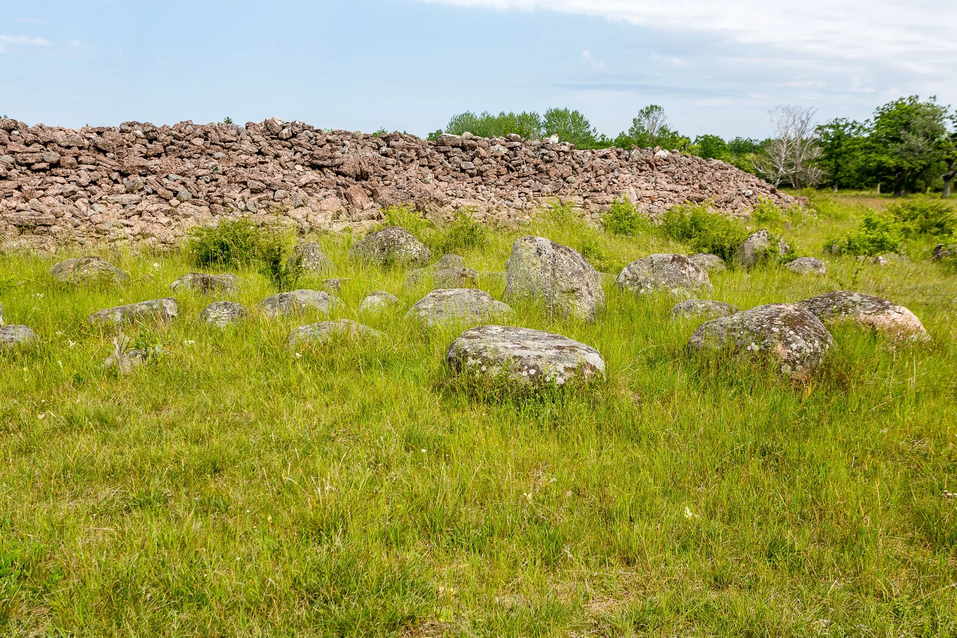
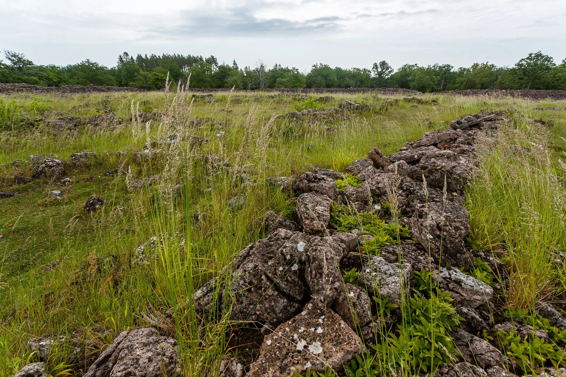
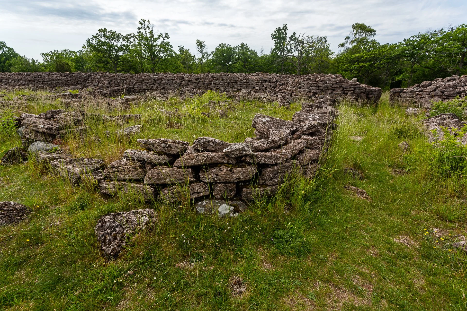
Inside the walls, 95 foundations, of which 88 are visible for buildings, sat closely together in an almost claustrophobic layout. Towards the rear, a larger courtyard space can be found. The walls are now only 4 meters high but are estimated to have reached 8-9 meters at their peak. The ruins are in better condition than Gråborg (excluding the entrance archway of Gråborg), which much more visible shape to the interior. You can walk between the foundation stones in the spaces that would have been streets.
Excavations of the site have found few artefacts and no cultural layer leading to the assumption that it was not a long term settlement, unlike Gråborg. However, the find of a single silver Arabic coin makes the site still visited, if not heavily in the Viking age.
After a rainfall, the air of the fortress ruins is rich with the smell of loam and flowers and dusty stone.
Sandby Borg
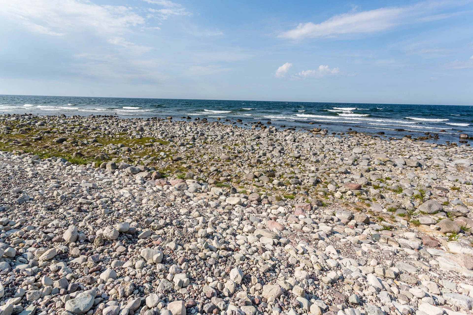
Sandby Borg is unusual in Öland in that it is situated by the coast, in this case, the east coast in a natural harbour of flat stone.
Sandby Beach
It is possible to see that the outside of Sandby Borg is constructed of two concentrically built walls, a lower exterior and a higher interior wall. The scattering of stones in a circle on the fortress's landward side is thought to show that the fortress was used more for defence from land than sea.
Sandby Borg
53 houses were found in the Borg, but all are gone. The stones carried off over the centuries for building. Archaeological work is ongoing at Sandby Borg, and numerous caches of ornaments, including rings, beads and silver buckles, have been found. Additionally, the skeletons of thirty people were found in an excavation, left where they fell in a violent slaughter. Children and the elderly did not escape the massacre, and valuable items were left behind, never to be taken, likely the end of Sandby Borg as a fortress.
The beach is a nice one, with good sand and long flat rocks reaching out into the sea like a shelf. RV and car parking is easily accessed in a fenced-off area with two drop toilets.
Eketorp Borg
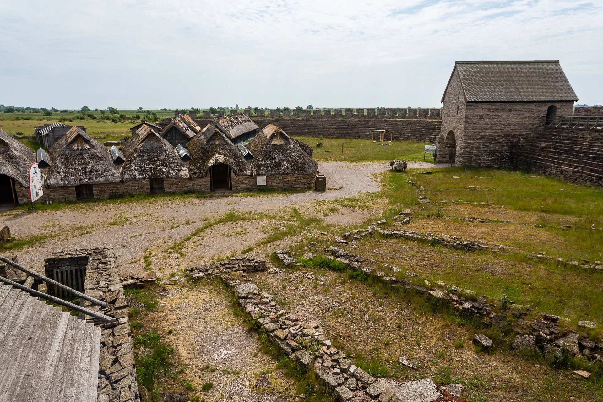
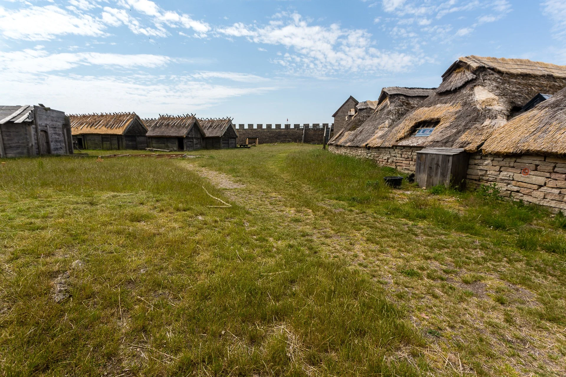
Archaeologists, stonemasons and carpenters worked together to recreate Eketorp as authentically as possible after its excavation.
The fortress was built in the fourth century and was in use until the middle of the thirteenth. For three hundred years, Eketorp was a fortified farming community, where 150-200 farmers and their families lived behind the high stone walls with their livestock. It was abandoned in the eighth century and deteriorated for almost five hundred years. Finally, it was restored with internal wooden buildings as a cavalry garrison for the soldiers and their families in the twelfth century.
The museum and the visitors centre were both designed by architect Jan Gezelius and are a study in opposites; The modern rectangular Scandi modern visitors centre is a stark contrast to the example of experimental archaeology that is the museum in the centre of Eketorp Borg, built of historic limestone walls and thatched roof.
Wandering through the museum and visitor centre, people in period costume are happy to explain the history to a visitor.
Despite looking like stacked stone, the walls are actually cavity walls, with two outer layers and a central section filled with smaller limestone and mortar. The reconstruction used limestone from the lime kiln at Borgholm Fortress.
Just outside the fortress, the remains of Offerdammen sacrifice pond can be visited. Unfortunately, nothing remains but the water where sacrifices were given. Still, archaeologists also believe this marshy land helped choose the site for Eketorp due to providing a measure of protection from attack from that direction.
Eketorp is worth visiting after you have seen Gråborg, Sandby or Ismantorps, as its 'more complete' state overshadows the ruins, which would perhaps be disappointing if seen after. In context, you get a much better sense of the scale of these fortresses and how people would have lived moving from ruins to reconstruction.
Borgholms Slott
Standing on the 30-meter high precipice of Landborgen Borgholms Castle benefits from the natural protection of the cliff and its view over the ocean and Borgholm harbour. First mentioned in writings in 1281, the oldest section of the castle is a round defensive tower of stone overlooking Kalmarsund and allowing the soldiers to notify with a signal fire the nearby troops and their allies in Kalmar Castle across the water.
Midsommar at Borgholms Slott
Borgholm was one of the first castles built by a Swedish monarch rather than by Danes or Germans, though both occasionally occupied the castle over Ölands troubled history. In 1397, with the signing of the Kalmar Union, uniting Sweden, Denmark and Norway in a theoretically united Scandinavia, that instead continued as a full conflict region.
From 1572-92 King Johan III transformed the castle from a fortification into a renaissance castle. Four wings were erected around an inner courtyard, and the central tower was raised. Additional towers were added on the corners, and the new Royal Palace was constructed in the old yard, next to the surviving medieval Royal Palace. Facing inland, bastions offered strong defence and Borgholm, and Kalmar castles have the most formidable still standing in Sweden.
The Kalmar War of 1611-13 saw the castle take substantial damage, and a desire from King Karl X Gustav to create a Baroque palace was never fulfilled. With the Peace of Roskilde in 1658, the shifting border of Sweden reduced Öland and Borgholms strategic importance. In the 18th century, it was abandoned, and in 1806 it was gutted by a fire. At the end of the 19th century, the ongoing work of preserving the castle began.
There are a lot of ruins to explore, despite the damage and fire. A small museum inside the castle gives history, and there is a chance to walk the walls and explore the spaces of the castle.
From the second and third floors, views over the water are excellent.
One wall has been preserved for its historical (and not so historic) graffiti.
View from Borgholms Slott
Sollidens Slott
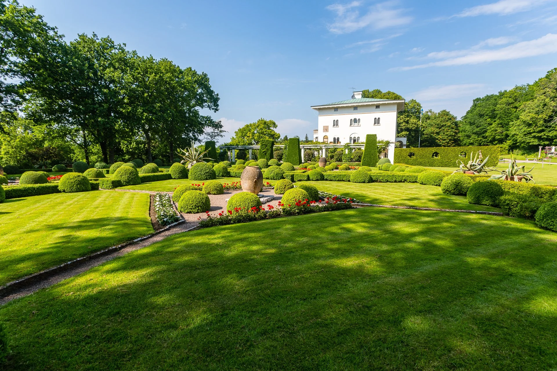
The summer residence of the Swedish Royal family, Sollidens, is a short walk through the Ludnet nature reserve at the foot of Borgholms Slott. The manor was built in 1906 by Queen Victoria, inspired by Italian homes and gardens.
The manor offers beautiful grounds to explore with cultivated flower beds as well as wilder areas. A short set of steps or a longer ramp takes you down to the lower gardens.
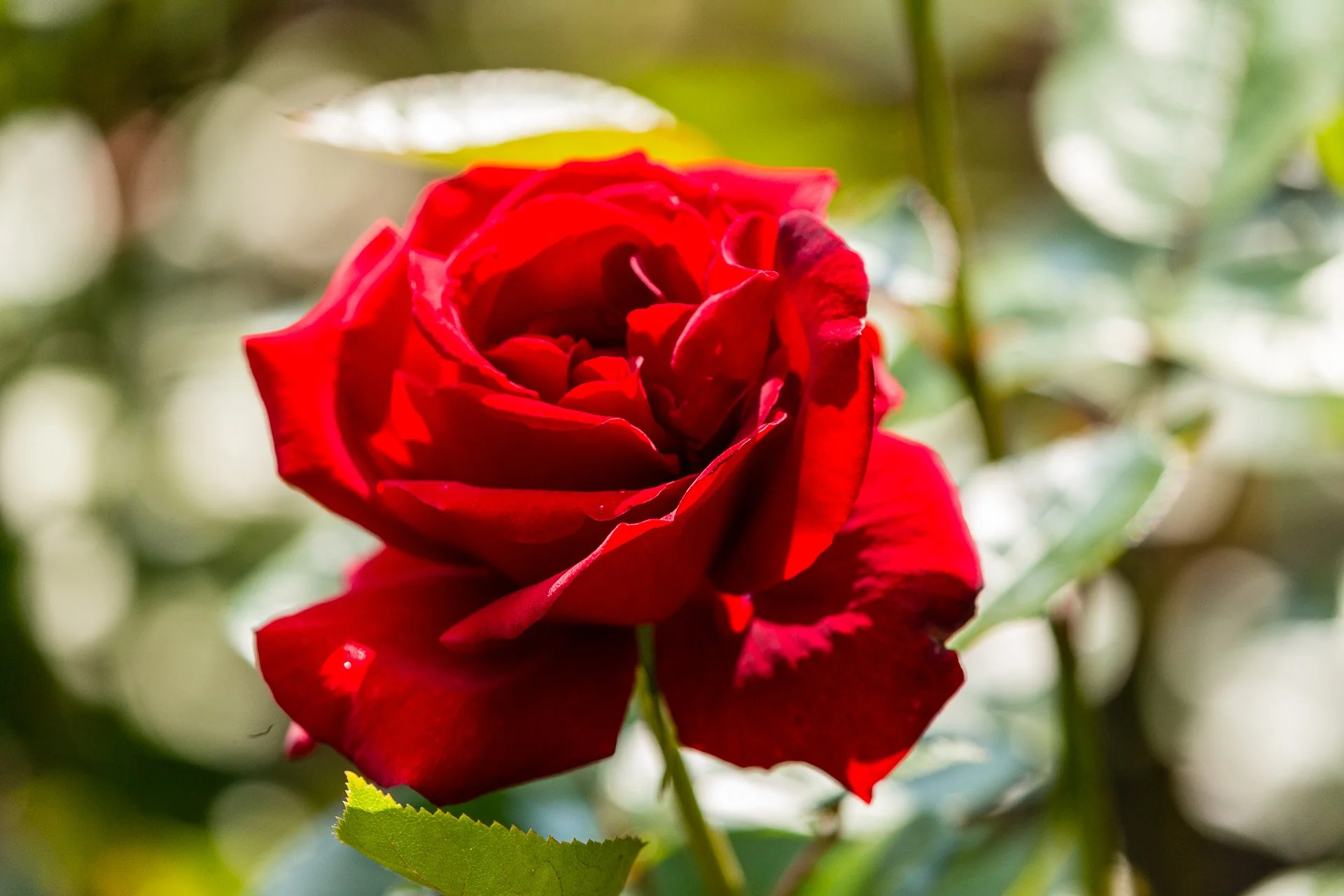
Three nationalities inspired the grounds. A geometrically planned Italian garden, it is a riot of colours. An English park with wide-open lawns allows for lazy summer walks. Finally, a Dutch Garden, a gift from Queen Wilhelmina and laid by Dutch gardeners in 1926, the scents of the roses can be overwhelming in summer.
Throughout the gardens, rockeries with plants native to Öland can be found, delighting more knowledgeable visitors. In addition, the Pavilion offers small exhibitions, which change regularly, currently on the royal family, and along one pathway, you find the pumpkin cottage.
A series of musical instruments can be found down a hidden path, allowing visitors to create music from the mysterious woods.
Just before the Dutch garden, laid out in 'rooms' where the children's birdhouse finalists, showcasing submissions from Ölands schoolchildren.
Windmills & Lighthouses
Långe Erik Fyrhus
At the very northern tip of Öland stands Långe Erik lighthouse. A short walk from the car park over a bridge brings you to Tall Erik's small park and beach. A short trail goes all the way around the island, which is mostly ringed with pebble beaches.
The northernmost point looks across into Trollskogen nature reserve, as the top of Öland forms the pincer shape of the land.
The lighthouse was built in 1845 and had 138 steps to the top. For a time, there was even a school on the island for the children of the lighthouse keepers. However, it was automated in 1976 and had only a metrological observer in residence.
While not the bird sanctuary of Långe Jan, around Långe Erik, there are still many birds to see.
Långe Jan Fyrhus
At the very southern tip of Öland stands Långe Jan Fyrhus. Built in 1785, likely by Russian prisoners of war, it is Sweden's tallest lighthouse at 41.6 meters, almost 10 meters higher than Långe Erik in the north. The stone came from Sankt Johannes Kapell and was formerly an open fire lighthouse.
Långe Jan Fyrhus
Over the years, it has been upgraded to now have a modern lamp.
Lerkaka Kvarnar
In the 19th century, approximately 2000 windmills of similar design could be seen on Öland. Now only around 350 remain.
Widely regarded as the most aesthetically pleasing row of windmills remaining, they are all in reasonably good condition of unpainted dark wood. At the back, a strange, almost unmodified log of wood pokes out of the building.
The name Lerkaka may refer to the sticky soil, and references to this name date back to 1467.
Whether by luck or design, facing the traditional windmills, over the road and past the rune-stone, there are a matching number of modern windmills mirroring the Larkaka Kvarnar.
Modern Windmills
While Öland is known for its historic windmills and wherever you drive, you will see them by the sides of the road in various states of repair, Öland is still an island of windmills.
Modern Windmills of Öland
Tall modern windmills dot the landscape, towering far higher than their old wooden cousins.
Runestones & Ruins
Öland is old, people have lived on this island for thousands of years, and the locals have kept many ruins and rune-stones in good order. Some have been reduced to scattered stones as the rock was carted away for building, but a surprising number remains.
https://en.wikipedia.org/wiki/List_of_runic_inscriptions_on_Öland
Jacktstenen
Jacktstenen at Borgholm Slott
At the top of a cairn in the grounds of Bergholms Slott stands the Hunt Stone, a memorial for King Kark XV by his hunting club and 'the people of Öland" and was a product of the National Romantic period of 1826-72 hearkening back to the dramatic Viking age.
Odens Flisor
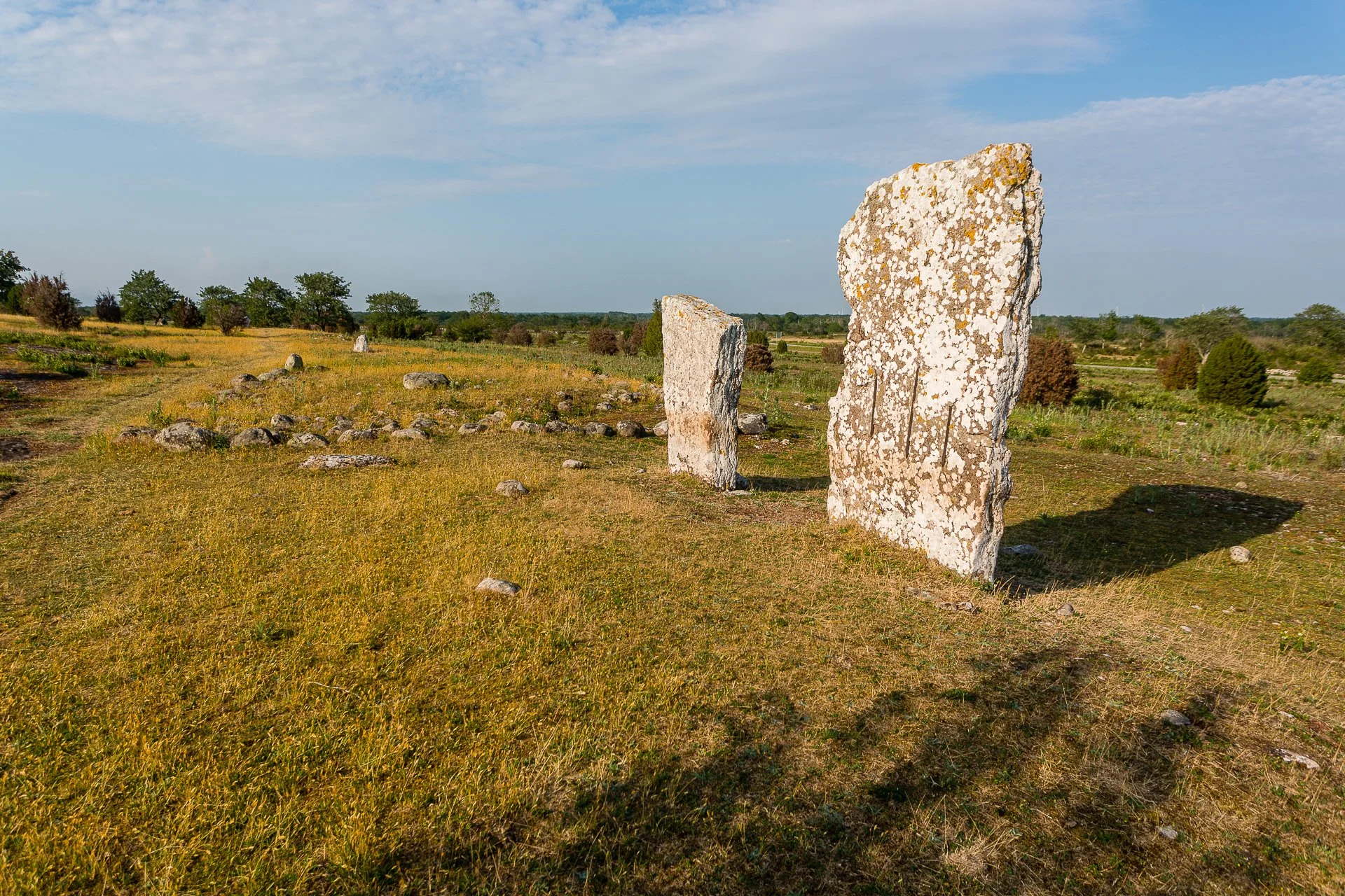
Not far from Noah's Ark and Ronnerum stands the triple rune-stone of Odin's Splinters. They are part of a grave from the late iron age and form part of the worship of the Æsir.
Odens Flisor
The legend of these stones holds the cracks in them are from Odin's sword when he drove his sword through them to tether Sleipnir, his eight-footed steed.
Gettlinge Gravfält
One of the largest gravesites in Öland at almost two kilometres long, it has approximately 250 graves, with 200 remaining. The tombs date from the Bronze and Iron Ages, and the most significant sight is the 30 meters long stone ship.
Next to the ship stand two limestone blocks. The site was in use for two thousand years, starting in 1,000 BCE.
Rönnerums Fornby
On one of Ölands many walking trails, Rönnerums Fornby is hard to reach by car. Its location was not on google maps (until Tog's Trek submitted it), and the long gravel road is overgrown with grass and plants.
Once you arrive at the end of the road, there is plenty of space for parking, and climbing over the turnstile take you into the field, a short walk and you see the signpost for Rönnerums Fornby, an Iron Age village.
The village consists of ten foundations of stones, now heavily overgrown. Seven are close together, making two farms, and the remaining three are a third farm to the north. The initial excavation was in 1928 of the south-easternmost farm. The floor was natural sand, and an oval fire-pit was the hearth—the village dates from 200-500 CE.
Not as impressive as many of the other archaeological sites on Öland; it is still worth a visit.
Öl 1 - Karlevistenen
The Karlevi Rune-stone is remarkable for several reasons. Dated to the late tenth century, it is a cylinder shape rather than the more common flat stone, with inscriptions all the way around.
Öl 1 - Karlevistenen
The front is the oldest record of a stanza of skaldic verse globally and composed in dróttkvætt, the Lordly Meter.
"Hidden lies the one
whom followed (most know that
the greatest deeds,
Þrud's warrior of battles
in this mound.
Never will a more honest
hard-fighting 'wagon-Viðurr' upon
Endill's expanses rule the land in Denmark."
On the reverse of the stone, it is written, which may mean "In the name of Jesus, particularly likely given the small carved cross on the stone.
Öl 37 - Lerkake Runsten
Facing the Larkake Windmill row is the Lerkake Rune-stone. Standing proud in a field, backed by a short stone wall, the inscription can still be read.
Öl 39 - Övra Bägby Runstenar
A limestone rune-stone set in a garden down a residential road is on the south side of the creek with Öl 40 on the north. They were both found in a bridge and moved to their current location in 1634. The inscription was colourised in 1987 and reads:
Öl 39 - Övra Bägby Runstenar
"Sven did (this) after his father Vikar; the only son raised the stone itself."
Öl 40 - Övra Bägby Runstenar
On the north of the creek the Övra Bägby rune-stone 40 is also limestone, but of a squarer, more short cut that its neighbour. The carved loop forms a ring, surrounded by a snake at the bottom. It was colourised twice in 1987 and 2004. The inscription reads:
Öl 40 - Övra Bägby Runstenar
"Gudbrand and Sven erected this stone after their good brothers Asvald and Helge."
Noah's Ark
From the late bronze age (1100-500 BCE), all of the stones in this magnificent ships setting remain. All around it in Karum's reserve are stones and standing stones. A number marking gravesites, some of which have been investigated and contained personal items and weapons.
The ship setting is long and thin; it almost looks like a map of Öland. There are on one site a pair of rune-stones with no runes visible.
As you explore the reserve, there are also a series of stone circle graves.
In terms of the nature reserve, it consists of sparse shrubs with the occasional scattered trees. Much less vibrant than most of Öland.
Museums & Galleries
Ölands Museum Himmelsberga
If there is one thing Sweden loves, it is an open-air museum of historic buildings, and Öland is no different. The Ölands Museum Himmelsberga is an extensive collecting of farm buildings, painted in Fala red. A small shop offers local wares, and a traditional windmill takes a proud place in the centre of an open field.
There is a small petting zoo with pigs, goats, chickens and rabbits.
In a rear field, a broken rune-stone, a may-poll and Swedish flag stood ready for later Midsommar celebrations.
There are several courtyards with bards, houses, and working machines to explore in the outdoor museum and a restaurant offering a good selection of food and drinks.
VIDA Art Museum
VIDA Art Museum is just off the main road to Borgholm and is almost offensively modern in design compared to the rest of Öland.
While I was there, there was an exhibition by Bertil Vallien, who works in heavy glass and steel. There is a robust Christian symbolism to his work, as well as a series of geometric shapes.
In the central gallery, Photographer Olle Ljungström's work was displayed. Two collections are shown. The first are images from his time in Afghanistan, influential works of a chaotic period. The second is more personal images from his Holga medium format film camera.
Katrina Westman's work is downstairs below the cafe, made of sensuous oil colours on the canvas; it has an organic look, despite its abstraction.
Parks & Gardens
Lugnet
Behind Bergholms Slott and acting as a pathway to Sollidens Slott lies the nature reserve of Lugnet. The steep slope that in history protected the castle has been devastated by Dutch Elm disease, the remains home to insects.
Lugnet Park
Only a kilometre of the path from Bergholm to Sollidens, it is still an excellent way to go between the two venues.
Ottenby birding station
In the south of Öland, the nature reserve where you can find Långe Jan is also home to the Ottenby birding station. Thousands of birds nest or visit the southern tip of Öland.
Byrums Raukar
A small spot on a sandy beach turns into Byrums Raukar or Byrum's Stacks. Carved over millions of years by the tides of the sea, they are small but incredible formations. They look almost like micro-fjords.
There is a lot of moss in the water, and small shallow pools form. Reaching out, shallow flat shelves of rock can be seen in the water.
Kapelludden
A small beach with huts and a toilet.
It is also home to Saint Britas Church and Kapelluddens Lighthouse.
Ställplats Ölandsbron
Officially a parking lot, Ställplats Ölandsbron gives a lovely view of the water with the long bridge in sight.
Ställplats Ölandsbron
It also got a small nature reserve and fire put just off to one side.
Restaurants & Bars
Mormors
A lovely wood cafe on the west coast halfway between the bridge and Borgholm, Mormors offers a range of hot drinks and homemade food and baked goods.
A small outdoor courtyard allows for views of the ocean.
Kaffetorpet
Kaffetorpet
An elegant cafe outside Sollidens Slott and facing small gourmet stores, Kaffetorpet is an ideal spot for refreshment after walking through the nature reserve separating Borgholm and Solliden Slotts.
Systrarna på Höjden
Systrarna på Höjden
A cafe, restaurant and ice cream parlour set on the grass facing Borgholm Slott, the food is excellent and quickly served, and the ice cream choices are a treat in the warm summer sun.
Lilla Hamnkontoret
The cute outdoor bar on the waterfront in Borgholm is a great place to stop for refreshment.


